Mount Moosilauke June 13, 2015
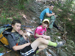
Spent the night at the Moosilauke Ravine Lodge, lodge is run by Dartmouth College, would highly recommend to anyone, staff was great, kids had fun in the triple deck bunk beds, and a great full breakfast in the AM.We packed and hit the trail head around 11 AM and took Gorge Brook Trail, 3.1 Miles with easy to moderate grades. Weather was great, sun, no clouds, and not many issues with bugs.
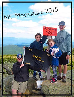
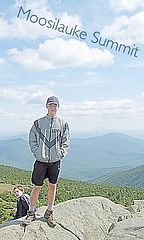
The first mile of Gorge brook was fairly straight with not much of a grade, the trail goes along the Gorge Brook and there is a clearly marked “final water point” about 2 miles away from the summit. We used the Katidyn Trail Water Pump, also highly recommended to get clean water from the brook. The trail then hits some switchbacks to the summit with a final rock staircase leading to a clearing above tree line. The weather was good with some very high winds. Once we got above tree line we had to put fleeces on, the temperature dropped about 15 degrees w/ heavy winds. The top of Mt. Moosilauke Moosilauke means “bald face” is completely above tree line, you need to prepare for this, reports say that the summit gets snow at least once a month year round and is comparable to the summit of Mt. Washington.The winds were so high you could lean into them, luckily there were rock walls built that you could hunker down behind to get some cover and enjoy the views of the Franconia Range, Bonds and Presidential Ranges. From the summit, and after some lunch we got back on the trail to head to the Beaver Brook Shelter, about 1.4 miles north of the summit.
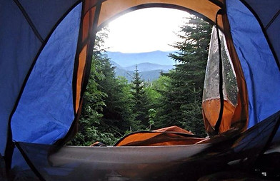
Tent Platforms and shelter was first come first serve, we were lucky enough to get the last shelter available with an incredible view of the Franconia Ridge. We set up our shelters and made our best attempt at making a tin can stove, looked easy enough on the YouTube video but couldn’t get the thing to burn for more than 2 minutes, but we were so hungry that the somewhat warm noodles still tasted good. I forgot to pack Savvy’s favorite blanket which caused some issues!! Luckily we had her pink elephant which had a pull string and played a lullaby so it wasn’t a bad substitute. Played some cards in the tent, made up a variant of “Old Maid” and all slept well. Day one totals: 4.9 miles w/ 2450 Ft. Elevation Gain.Woke up around 8:30 ish and hit the trail after eating more noodles for breakfast, got the tin can stove to work better this time, noodles were hot, but noodles were a bad choice for breakfast food (note to self)
Hit the trail south toward Asquam Ridge, also known as Asquamchumauke Ridge Trail, very easy trail, mostly downhill, The trail is marked with a sign that only reads “Ridge Trail” which causes some confusion among some of the hikers we ran into. The trail had some steep areas but was dry and again we lucked out with the weather, sunny in the high 70’s. There were some limited views through the trees of Mt. Moosilauke and you could determine how close you were getting to the end by listening to roar of Baker River ahead which meant you were near the Ravine Lodge.This trail crosses over Mt. Blue and Mt. Jim, both over 4000 foot in prominence, but not on the list of NH 4000 footers because they are sub-peaks of Moosilauke. We all came out of the woods at 12:30 PM, completing over 9 miles total on this loop. This was our 10th 4000 Footer, 38 more left!!